Loading...

 I’m passionate about using drone technology to offer fresh perspectives on the world around us. My work focuses on two key areas: photogrammetry and aerial photography.
Through advanced photogrammetry, I turn aerial images into detailed 2D and 3D models. By capturing multiple images from different angles and analyzing them carefully, I create accurate, high-resolution models that help you visualize spaces in ways that traditional methods can’t. Whether it’s for architectural planning, land surveying, or environmental projects, these models provide precise measurements and a new way to see the world from above.
My aerial photography services offer a unique perspective that’s both striking and meaningful. I strive to capture moments and spaces from above with clarity and artistry. From expansive landscapes to architectural highlights, each photograph tells a story. These images are perfect for real estate showcases, marketing materials, or simply preserving unforgettable views in all their grandeur.
For me, this work isn’t just about drones or technology. It’s about capturing the essence of a space or a moment. I bring precision, creativity, and care to every project, and I’m always exploring new ways to reveal perspectives that inspire and inform. Explore the world through my lens, where every angle has a story and every detail comes to life.
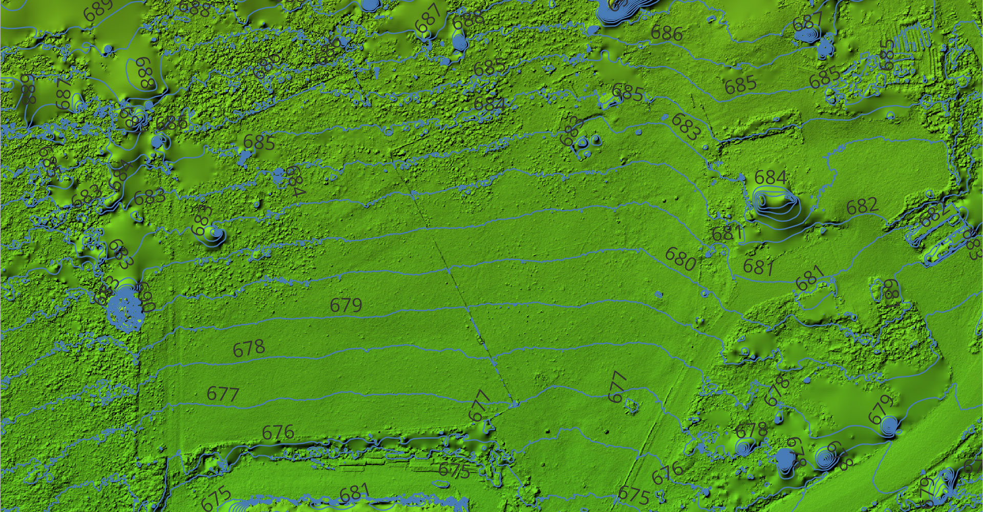
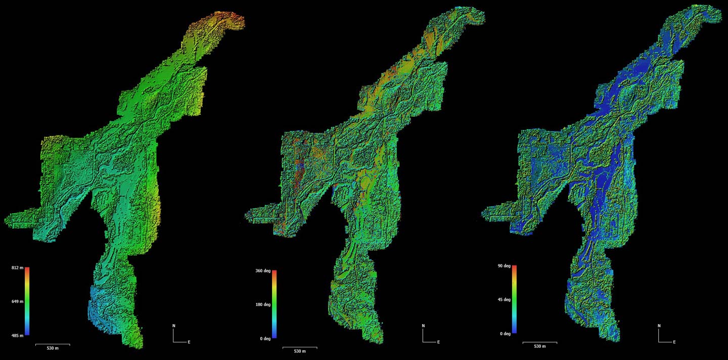
Digital Elevation Model
Digital Elevation Model
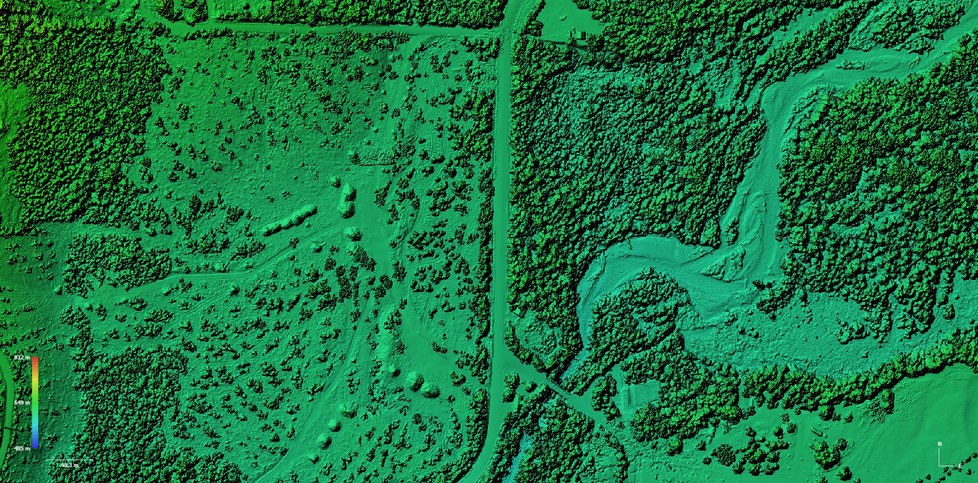
Digital Elevation Model
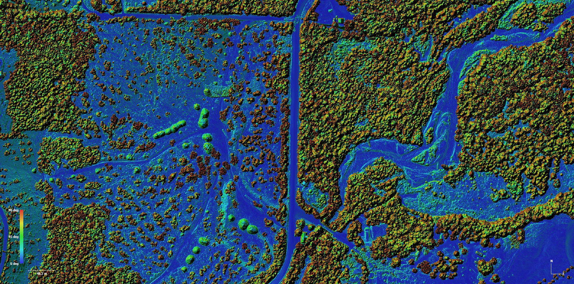
Digital Elevation Model
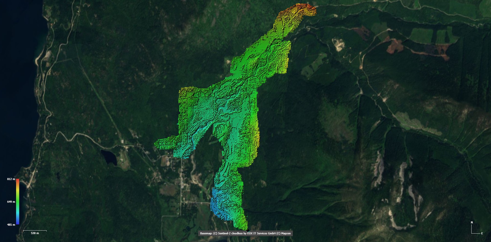
Satelite Map Overlay
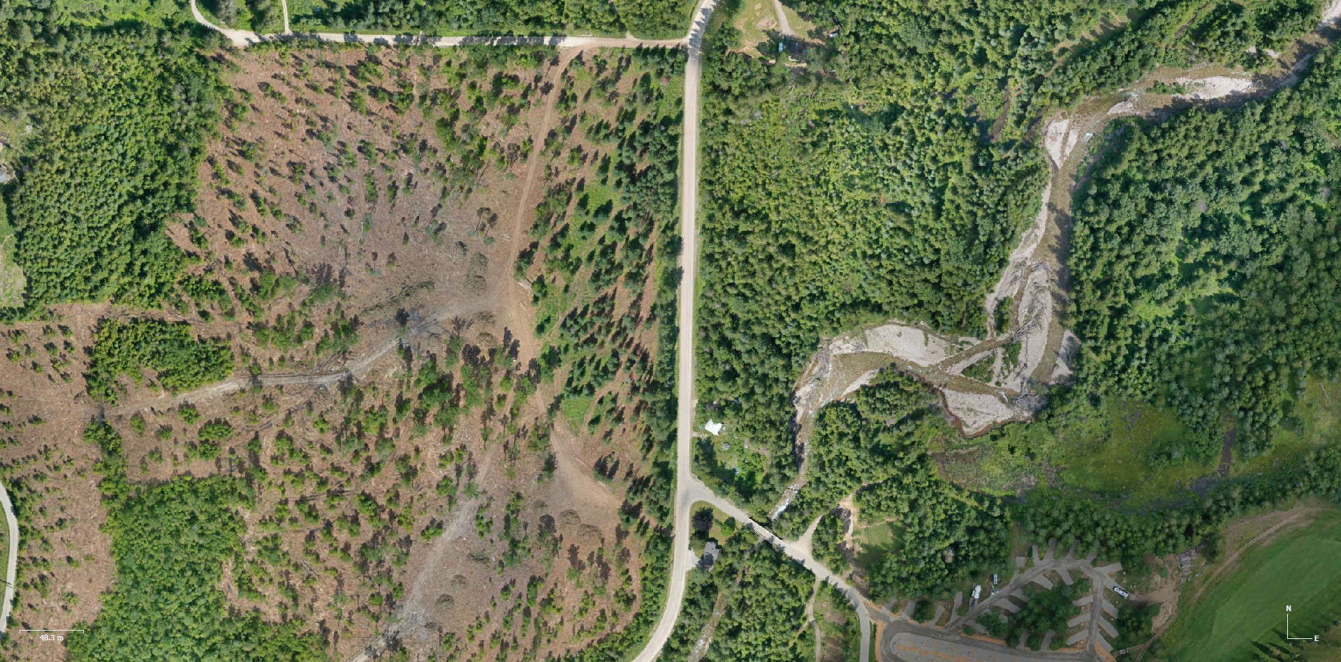
Orthomosaic Reconstruction
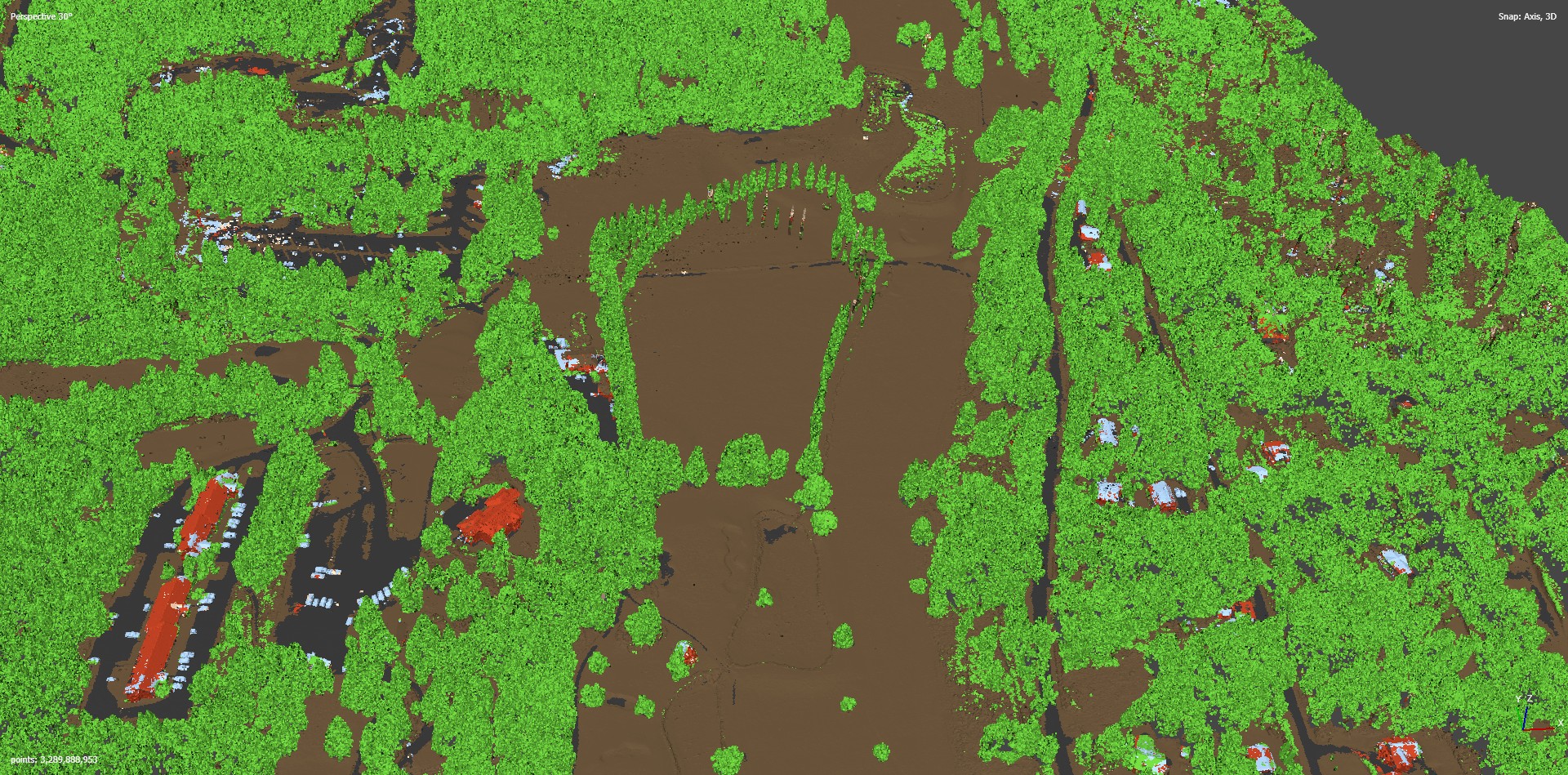
Point Cloud
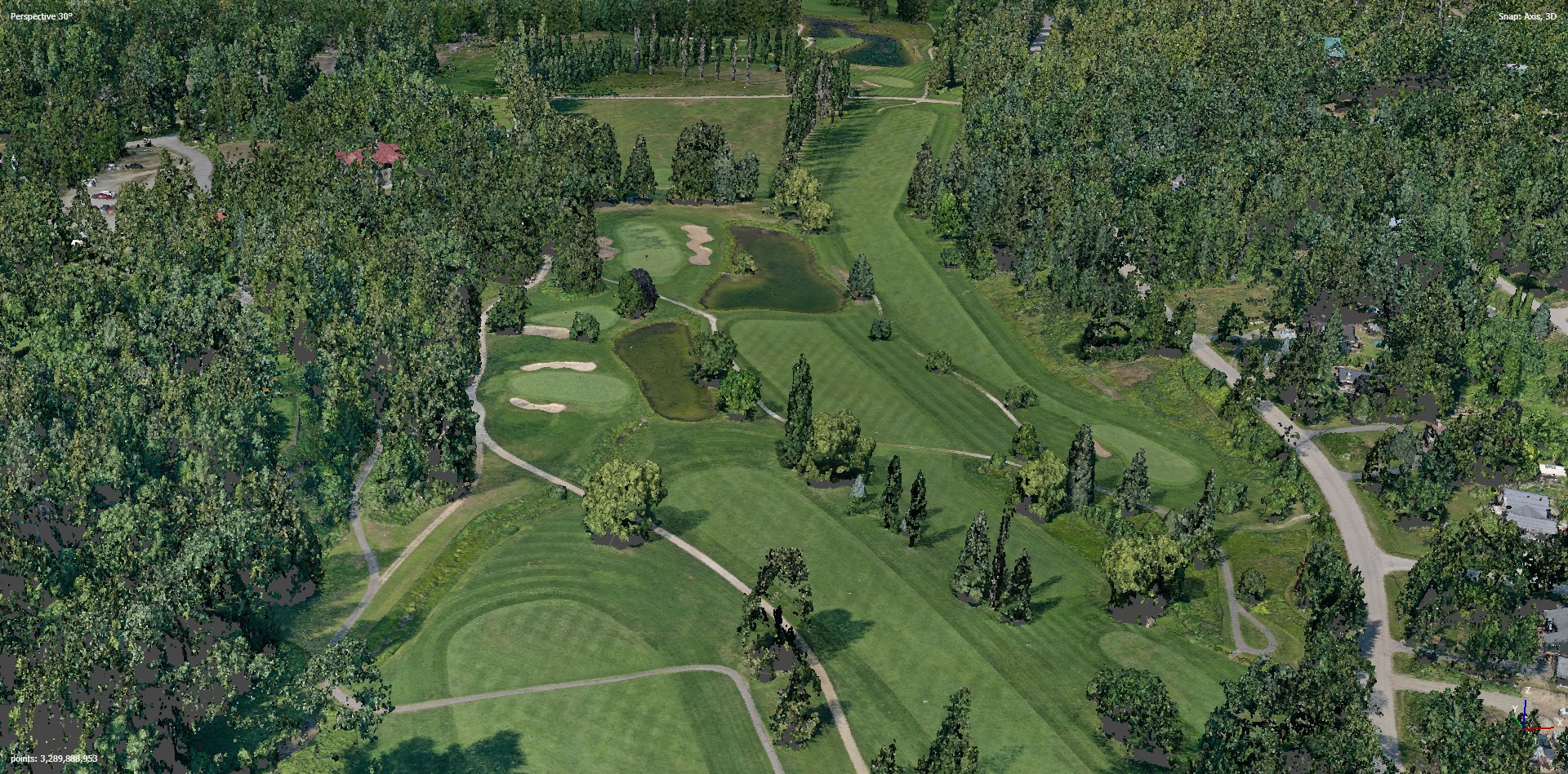
Point Cloud
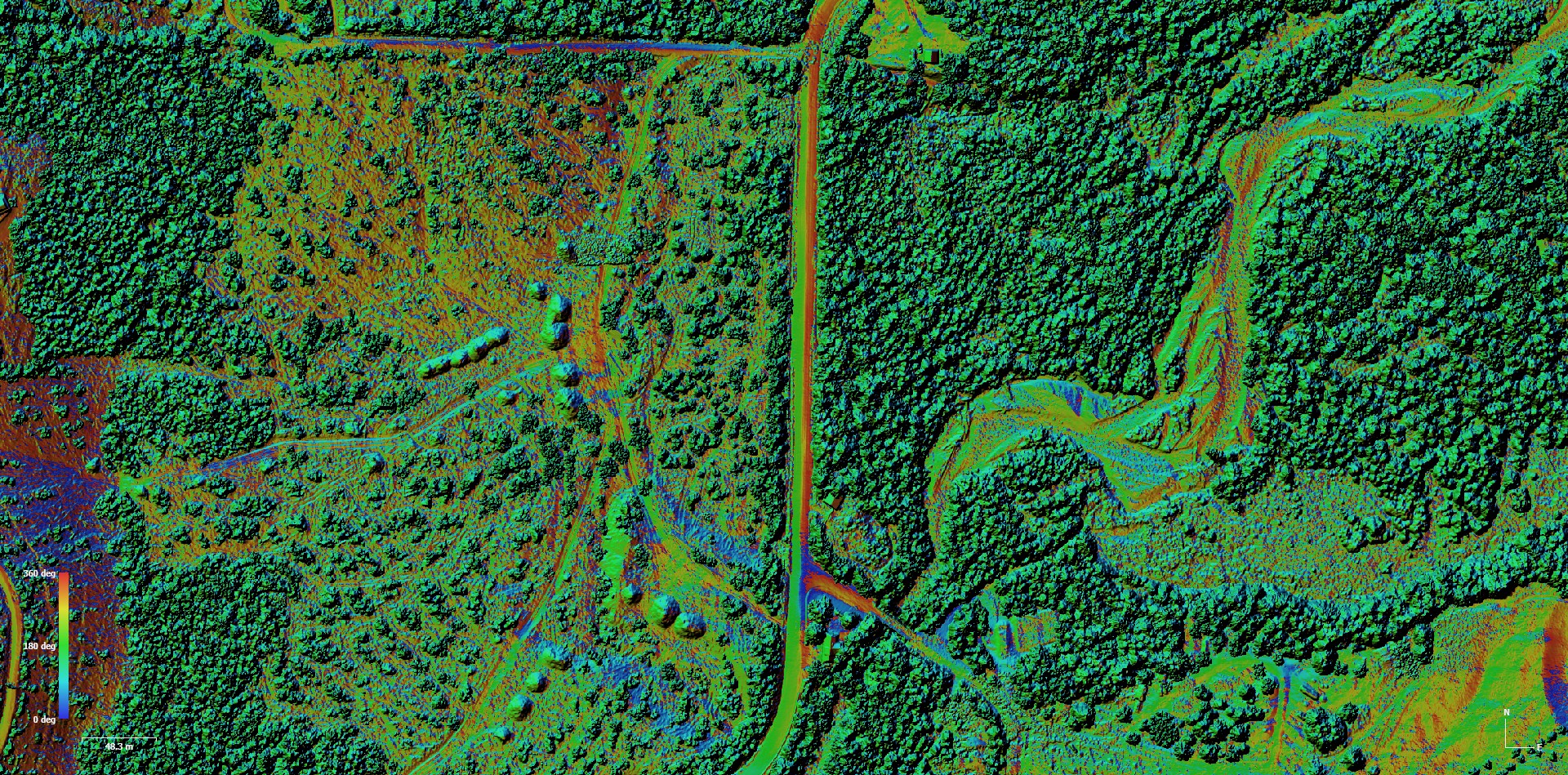
Depth Map
I offer advanced photogrammetry services that transform aerial images into highly detailed 2D maps and 3D models. Using modern drone technology, I capture multiple overlapping images from different angles and process them into accurate digital models of real-world environments.
Through careful data processing and analysis, these individual images are combined to create precise visualizations that allow you to measure, analyze, and better understand a space in ways traditional photography cannot provide.
These models can also generate valuable terrain information such as elevation, slope, and aspect data, providing deeper insight into landscapes and project areas.
In addition to 3D modeling, I create orthomosaic maps—high-resolution composite aerial maps produced by stitching together hundreds or thousands of images. These maps provide a perfectly aligned, distortion-corrected view of an entire project area and are widely used in industries such as construction, agriculture, land development, and environmental monitoring.
My goal is to provide clear, accurate, and practical aerial data that helps clients visualize their projects and make informed decisions.
If you're interested in using photogrammetry for your project, feel free to contact me for more information or a quote.
Digital Elevation Model
Digital Elevation Model
Digital Elevation Model
Digital Elevation Model
Satelite Map Overlay
Orthomosaic Reconstruction

Point Cloud

Point Cloud
Depth Map